24 May 2006

Some funky chemistry


Autumn,
when the flow is slow,
the surface is
skin-like.


Bubbles feature too,


even in mid-winter.

22 May 2006

Reflections on the creek


Sometimes the creek insists you stop ... take stock.


21 May 2006

Antechamber Bay

Having mentioned Antechamber Bay, and shown a satellite view of it, here is a photo of the beach from the northernmost point.


I wish I knew more about geology; one day I will find out more about the rock formations.
The beach itself is one of the most beautiful you could wish to see, with fine white sand, crystal clear water and stunning rock formations at the northernmost point.

At the far point of the photo is the spot where the Chapman River (including, by then, Shorty Creek) creek flows into the ocean through a meandering lagoon.


Sometimes the ocean brings the "seaweed" in.

Where did these images come from?

I have taken most of the photos for this blog, but it has to be said that the closeups and many more, are the work of friends who DO know how to use their cameras well.

Others images are taken from the South Australian Tourism's "Kangaroo Island Visitor and Information Guide" available from www.tourkangarooisland.com.au

There is a more general SouthAustralian information source at www.southaustralia.com which touts South Australia as "a brilliant blend".

Maps and uptodate road advice is available from the RAA of SA at http://www.raa.net/

Less detailed maps are at http://www.southaustralia.com/maps.asp with the map of Kangaroo Island itself at
http://www.southaustralia.com/maps_region.asp?page_title=kangaroo%20 island


The maps are available as Acrobat Reader files, however if you are not already a user of the Foxit Reader, then may I take this opportunity to introduce it. It is free, a small download and effective. http://www.foxitsoftware.com/pdf/rd_intro.php

Finally, a tribute to the people who taught me to have a go at this kind of technology, the contributors to the ABC's Tech Talk Forum at http://www2b.abc.net.au/science/techtalk/

And for good listening of all kinds:)

www.abc.net.au " ... (Y)OUR ABC"

20 May 2006

Shorty Creek?

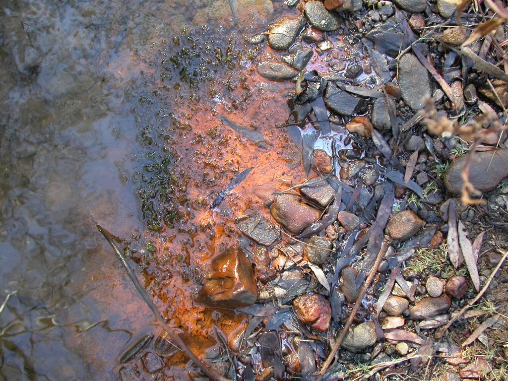
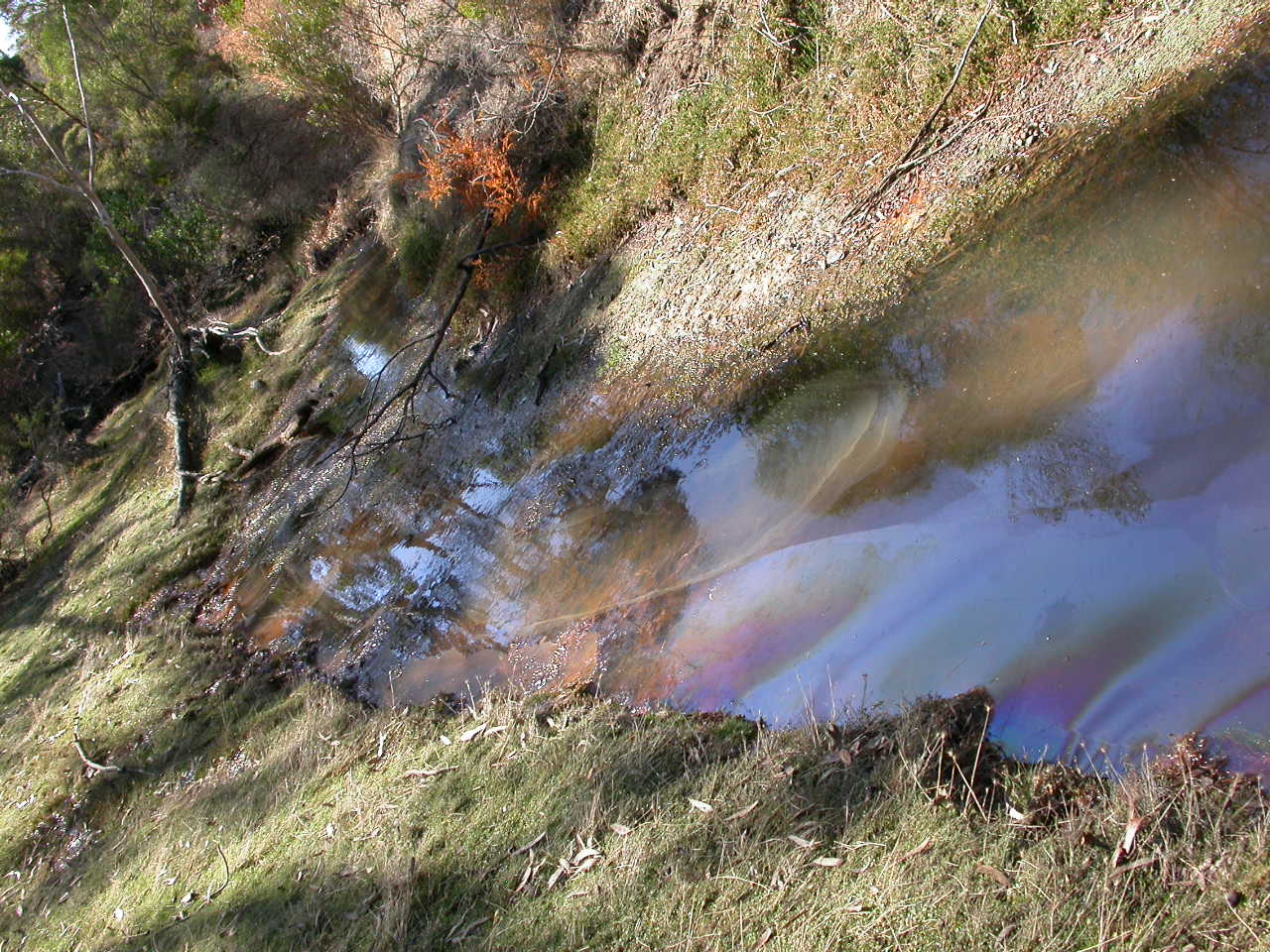
In the last two years I have got to know a small creek.
What is its name?

I don't know.

It is going to be "Shorty Creek" for this blog, named for the road leading to it; itself named for a family who once lived locally.

More to the point, where is it?

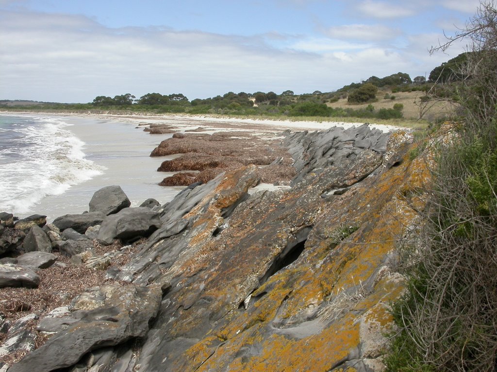
It is on the Eastern end of Kangaroo Island, in South Australia.


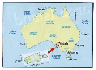
Half way along the 34K Penneshaw-Cape Willoughby Road, Shorty Road branches inland (due west) from Antechamber Bay, at the Lashmar Conservation Park.

Shorty Road ends where a large scrub block (with the creek flowing through it) meets cleared farmland.


The creek flows south through the bushland then curves east and north again, before flowing into Antechamber Bay through a large lagoon

Here is the relevant googlemap URL
You can click on a map view, a satellite view or a combination of the two.
Unfotunately there is not yet a detailed satellite view.

http://local.google.com/?t=h&om=0&ll=-35.797209,138.053513&spn=0.062376,0.089951